Another big visibility reducer is fog. We will get more into fog forecasting tomorrow but here is a brief overview.
Fog
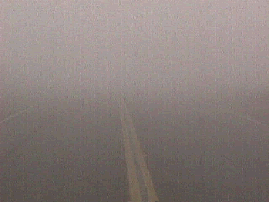
At most locations, fog is the most common visibility restriction. The formation of fog results from air being brought to saturation by cooling or adding moisture. Fog and stratus are both products of condensation and saturation. As the relative humidity of the air increases, and the visibility decreases due the increase of water vapor in the air, the landscape becomes masked with a grayish tint. As the relative humidity gradually approaches l00 %, the condensation particles grow larger, and condensation begins on the less-active nuclei. At this point, a large fraction of the available nuclei have water condensing onto them, causing the droplets to grow even bigger, until eventually they become visible to the naked eye. The increasing size and concentration of droplets further restricts visibility. There are three fog types: radiation, advection, and upslope fog.
Haze is another visibility restrictor, but seldom brings vibilities to mission-limiting thresholds.
Air Refueling In-Flight Visibility
In these days of rapid deployment to global “hot spots,” many air refueling missions occur. Could you determine in-flight visibility? The most critical time during air refueling, as far as in-flight visibility is concerned, is just prior to and during hookup when hookup must be accomplished visually. Once hookup is accomplished, in-flight visibility should not interfere with the refueling operation. Aircrews base the current GO/NO GO decision for air refueling on in-flight visibility of less than 1 nautical mile. Aircraft involved in air refueling operations will often descend or ascend within the 5,000-foot air refueling route (AR) window to seek better in-flight visibility. Usually aircrews conduct air refueling operations at altitudes generally above 23,000 feet with an altitude of 29,000 feet considered optimum. In-flight visibility is optimal (7+ nautical miles) when the AR is cloud free, but many ARs tend to cover several hundred miles. Most of the time in certain AORs, clouds are likely to be present along a portion of a given AR. Use the following rules of thumb gleaned from several "old" sources.
Cloud Cover
This rule uses cloud cover amount for determining in-cloud flight visibility when the cloud deck is assumed to be greater than or equal to 2,000 feet in thickness.
- Clear -- 7+ nautical miles
- 3/8 or less -- More than 3 nautical miles
- 3/8 to 5/8 -- 1 to 3 nautical miles
- 6/8 to 8/8 -- Less than 1 nautical mile
Temperature/Dew Point Depressions
Another rule of thumb for determining in-cloud flight visibility is by using temperatures. When the temperature is below -30° C, then the in-cloud flight visibility will be a 1/2 nautical mile for each degree of dew point depression.
Example: A dew point depression of 4° C (SCT to BKN) would yield an in-cloud flight visibility of 2 nautical miles, and a dew point depression of 1° C (OVC) would yield 1/2 nautical mile.
Cloud Thickness
In-cloud flight visibility may be approximated based upon cirriform cloud thickness. Keep in mind that the vertical visibility in thin cirrus is usually better than the horizontal visibility. Even though ground observers can see up through the cirrus or pilots can see the ground through it, the horizontal visibility in the cirrus may be limited. Common rules of thumb are:
- If the cloud deck is thin-broken to thin-overcast, forecast 1-2 nautical miles in-cloud flight visibility.
- If the cloud deck is thicker (i.e., opaque, broken to overcast), forecast 1/2 nautical mile in-cloud flight visibility.
Thunderstorm Cirrus
Due to the variability in conditions, thunderstorm cirrus is possibly the most difficult in-cloud flight visibility too forecast for. This cirrus ranges from layered and sporadic (i.e., patchy) too thick and dense. Some common rules of forecasting in-cloud flight visibility are:
- If there is no significant cloud cover (3/8 or less) at flight level, forecast at least 3 nautical miles in-flight visibility.
- If there is significant cloud cover (4/8 or more) but at least 2,000 feet vertical airspace with 3/8 or less clouds between layers, forecast 1 to 3 nautical miles in-flight visibility.